This article needs additional citations for verification. (June 2009) |
Mechi Zone
मेची अञ्चल | |
|---|---|
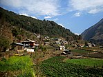
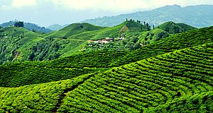
Dudh Kunda at Yamtari Glacier, Lelep village, view from Pathibhara temple, Gunsa village (clockwise from top), Phungling bazaar, Lush Green Tea Gardens are what makes Ilam district popular., Arjundhara Dham, Phidim bazar area | |
 | |
| Country | |
| Named for | Mechi River |
| Capital | Ilam Bazaar |
| Largest city | Mechinagar |
| Districts | |
| Area | |
| • Total | 8,196 km2 (3,164 sq mi) |
| Highest elevation | 8,586 m (28,169 ft) |
| Lowest elevation | 59 m (194 ft) |
| Population (2011) | |
| • Total | 1,422,182 |
| • Rank | 11th |
| • Density | 170/km2 (450/sq mi) |
| Time zone | UTC+5:45 (Nepal Time) |
Mechi (Nepali: मेची अञ्चल ) was one of the fourteen zones of Nepal[1] until the restructuring of zones to provinces, comprising four districts; namely Ilam, Jhapa, Panchthar and Taplejung. Its headquarters are at Ilam.[clarification needed] It comes under the Eastern Development Region of Nepal. The Indian state of Bihar is to the south, West Bengal and Sikkim in the east and Tibet to the north. The largest town is Damak in the Terai. The majority of the population in Mechi are Limbu, Chettri, Bharmin, Maithil and Meche.


