This article's tone or style may not reflect the encyclopedic tone used on Wikipedia. (April 2022) |
Melitopol
Melitopil | |
|---|---|
From top to bottom and left to right: | |
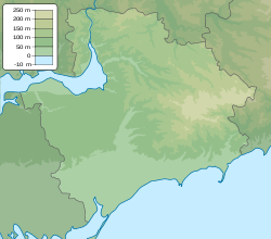
| Coordinates: 46°50′56″N 35°22′03″E / 46.84889°N 35.36750°E | |
| Country | |
| Oblast | Zaporizhzhia Oblast |
| Raion | Melitopol Raion |
| Hromada | Melitopol urban hromada |
| Established | 1784 |
| City rights | 1842 |
| Government | |
| • Mayor | Vacant |
| Area | |
| • Total | 51 km2 (20 sq mi) |
| Population (2022) | |
| • Total | 148,851 |
| Postal Index | 72300 |
| Climate | Cfa |
| Website | www |
 | |
Melitopol[a] is a city and municipality in Zaporizhzhia Oblast, southeastern Ukraine. It is situated on the Molochna River, which flows through the eastern edge of the city into the Molochnyi Lyman estuary. Melitopol is the second-largest city in the oblast after Zaporizhzhia and serves as the administrative centre of Melitopol Raion. As of January 2022, Melitopol's population was estimated to be 148,851.[1]
Melitopol has been under Russian control since March 2022. On September 30, 2022, the city was formally annexed by the Russian Federation; however, it remains internationally recognized as sovereign territory of Ukraine.
The city is located at the crossing of two major European highways: E58 Vienna – Uzhhorod – Kyiv – Rostov-on-Don and E105 Kirkenes – St. Petersburg – Moscow – Kyiv – Yalta. An electrified railway line of international importance goes through Melitopol. The city was once known as "the gateway to the Crimea"; prior to the 2014 Russian annexation of Crimea 80% of passenger trains heading to the peninsula passed through it and during the summer, road traffic reached 45,000 vehicles per day.
Cite error: There are <ref group=lower-alpha> tags or {{efn}} templates on this page, but the references will not show without a {{reflist|group=lower-alpha}} template or {{notelist}} template (see the help page).
- ^ Чисельність наявного населення України на 1 січня 2022 [Number of Present Population of Ukraine, as of January 1, 2022] (PDF) (in Ukrainian and English). Kyiv: State Statistics Service of Ukraine. Archived (PDF) from the original on 4 July 2022.


