| UNESCO World Heritage Site | |
|---|---|
| Location | Oromia, Ethiopia |
| Criteria | iii, iv, v |
| Reference | 13rev |
| Inscription | 2024 (46th Session) |
| Coordinates | 8°42′18″N 38°35′57″E / 8.7051°N 38.5991°E |
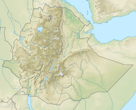
Melka Kunture (Amharic: መልካ ቁንጥሬ) is a Paleolithic site in the upper Awash Valley, Ethiopia. It is located 50 kilometers south of Addis Ababa by road, across the Awash River from the village of Melka Awash. Three waterfalls lie downstream of the bridge across the Awash here, which provides access south to Butajira.[1] The site became a World Heritage Site in 2024.[2]
The Basin surface area is around 3,000 km2 and it is delimited by Pliocene volcanoes. The main volcanic centers are Wachacha and Furi in the North, Boti and Agoiabi in the South. Its eastern limit is marked by the main graben of the Ethiopian Rift belonging to the large East African Rift system.[3]
The Melka Kunture area is made up of valleys whose inner terraces resisted erosion. The visible thickness of these deposits is around 30 m, but the cumulative thickness of the various levels is about 100 m. A recent structural, tephrostratigraphic and lithostratigraphic approach provides new insights into the evolution of the environmental background for hominin activities in this area. The valley of the Awash River has been a focus of hominin occupation since 4 to 5 Ma. The Awash regularly reestablished its course after each important volcanic episode and each time established a new basal level of erosion. The water flow of this river and its tributaries provided the sedimentary context of reworked volcanic materials that buried and preserved the archaeological sites within the Melka Kunture Formation.[4]
- ^ Philip Briggs, Ethiopia: The Bradt Travel Guide, 3rd edition (Chalfont St Peters: Bradt, 2002), p. 374
- ^ "Melka Kunture and Balchit: Archaeological and Palaeontological Sites in the Highland Area of Ethiopia". UNESCO World Heritage Centre. Retrieved 30 July 2024.
- ^ Mohr, P., 1999. Le système des rifts Africains. Environnement Géologique et géographique. In: Gallay, A. (Ed.), Commentl’Homme? À la découverte des premiers hominidés d’Afrique del’Est. Éditions Errance, Paris, pp. 231–288.
- ^ Kieffer, G., Raynal, J.-P., Bardin, G., 2002. Cadre structural et vol-canologiques des sites du Paléolithique ancien de Melka Kunture(Awash, Ethiopie): premiers résultats. In: Raynal, J.-P., Albore-Livadie, C., Piperno, M. (Eds.), Hommes Et Volcans. De l’éruptionà l’objet. Les Dossiers de l’Archéologie 2, Proceedings Sympo-sium 15.2 , XIV UISPP Congress, Liège, 2001, pp. 77–92.
