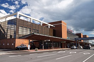
Memanbetsu Airport 女満別空港 Memanbetsu Kūkō | |||||||||||
|---|---|---|---|---|---|---|---|---|---|---|---|
 | |||||||||||
| Summary | |||||||||||
| Airport type | Public | ||||||||||
| Owner | Hokkaido Prefecture | ||||||||||
| Operator | Hokkaido Airports | ||||||||||
| Serves | Abashiri, Kitami | ||||||||||
| Location | Memanbetsu, Ōzora, Hokkaido, Japan | ||||||||||
| Elevation AMSL | 109 ft / 33 m | ||||||||||
| Coordinates | 43°52′50″N 144°09′51″E / 43.88056°N 144.16417°E | ||||||||||
| Map | |||||||||||
 | |||||||||||
| Runways | |||||||||||
| |||||||||||
| Statistics (2015) | |||||||||||
| |||||||||||
Source: Japanese Ministry of Land, Infrastructure, Transport and Tourism[1] | |||||||||||
Memanbetsu Airport (女満別空港, Memanbetsu Kūkō) (IATA: MMB, ICAO: RJCM) is an airport in the Memanbetsu section of Ōzora, a town in Hokkaidō, Japan. The airport is close to Shiretoko National Park and consistently has over one million passengers per year.[2]
- ^ "Memanbetsu Airport" (PDF). Japanese Ministry of Land, Infrastructure, Transport and Tourism. Archived from the original (PDF) on 21 October 2016. Retrieved 7 January 2017.
- ^ Airports In Hokkaido Archived 2006-12-08 at the Wayback Machine

