Merikarvia
Sastmola | |
|---|---|
Municipality | |
| Merikarvian kunta Sastmola kommun | |
 The town center along the Kauppatie street | |
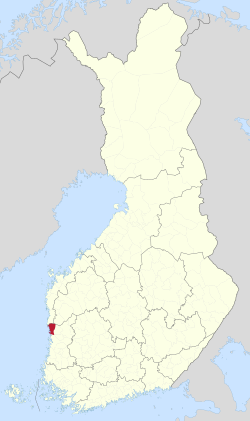
 Location of Merikarvia in Finland | |
| Coordinates: 61°51.5′N 021°30′E / 61.8583°N 21.500°E | |
| Country | |
| Region | Satakunta |
| Sub-region | Pori sub-region |
| Charter | 1639 |
| Government | |
| • Municipal manager | Juha Vasama |
| Area (2018-01-01)[1] | |
| • Total | 1,246.22 km2 (481.17 sq mi) |
| • Land | 446.28 km2 (172.31 sq mi) |
| • Water | 800.2 km2 (309.0 sq mi) |
| • Rank | 194th largest in Finland |
| Population (2024-08-31)[2] | |
| • Total | 2,918 |
| • Rank | 218th largest in Finland |
| • Density | 6.54/km2 (16.9/sq mi) |
| Population by native language | |
| • Finnish | 96.3% (official) |
| • Swedish | 0.5% |
| • Others | 3.3% |
| Population by age | |
| • 0 to 14 | 13.9% |
| • 15 to 64 | 50.6% |
| • 65 or older | 35.5% |
| Time zone | UTC+02:00 (EET) |
| • Summer (DST) | UTC+03:00 (EEST) |
| Climate | Dfc |
| Website | www.merikarvia.fi |
Merikarvia (Finnish: [ˈmeriˌkɑrʋiɑ]; Swedish: Sastmola) is a municipality in Finland. It is located in the Satakunta region. The neighboring municipalities are Isojoki, Kristinestad, Pomarkku, Pori and Siikainen.
The municipality has a population of 3,169 (2024)[2] and it covers an area of 1,246.22 square kilometres (481.17 sq mi), of which 800.2 km2 (309.0 sq mi) is water.[1] The population density is 6.54 inhabitants per square kilometre (16.9/sq mi).
The municipality is unilingually Finnish. The coastline was formerly Swedish-speaking. Merikarvia is known for the Oura Archipelago, which is part of the Bothnian Sea National Park.
- ^ a b "Area of Finnish Municipalities 1.1.2018" (PDF). National Land Survey of Finland. Retrieved 30 January 2018.
- ^ a b c "Finland's preliminary population figure was 5,625,011 at the end of August 2024". Population structure. Statistics Finland. 24 September 2024. ISSN 1797-5395. Retrieved 25 September 2024.
- ^ "Population according to age (1-year) and sex by area and the regional division of each statistical reference year, 2003–2020". StatFin. Statistics Finland. Retrieved 2 May 2021.
- ^ a b "Luettelo kuntien ja seurakuntien tuloveroprosenteista vuonna 2023". Tax Administration of Finland. 14 November 2022. Retrieved 7 May 2023.
