Metro Manila
Kalakhang Maynila Kamaynilaan | |
|---|---|
| National Capital Region | |
| Motto: Dangal nitong Bayan! | |
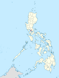
 Location in the Philippines | |
| Coordinates: 14°35′N 121°00′E / 14.58°N 121°E | |
| Country | |
| Island | Luzon |
| Managing entity | Metropolitan Manila Development Authority |
| Established | November 7, 1975[1] (as a public corporation) January 23, 1976 (as a region)[2] June 2, 1978[3] (as the NCR) |
| Composed of | 16 cities 1 municipality |
| Government | |
| • Type | Metropolitan government under a decentralized framework[4] |
| • Body | Metropolitan Manila Development Authority |
| • MMDA Chairman | Romando Artes (acting) |
| • Metro Manila Council President | Francis Zamora |
| Area | |
| • Region | 636.00 km2 (245.56 sq mi) |
| Population (2020 census)[5] | |
| • Region | 13,484,462 |
| • Density | 21,202/km2 (54,910/sq mi) |
| • Metro | 26,700,000 |
| Demonym(s) | English: Manilan, Manileño; Spanish: manilense,[a] manileño(-a) Filipino: Manileño(-a), Manilenyo(-a), taga-Maynila |
| GDP (nominal) | |
| • Region | $136.12 billion (2023)[7] |
| • Per capita | $10,108 (2023)[7] |
| Time zone | UTC+8 (PST) |
| IDD : area code | +63 (0)2 |
| ISO 3166 code | PH-00 |
| Languages | |
| HDI | |
| HDI rank | 2nd (2019) |
| Website | mmda |
| |
Metropolitan Manila[1] (Filipino: Kalakhang Maynila), commonly shortened to Metro Manila[a] and formally the National Capital Region (NCR;[3] Filipino: Pambansang Punong Rehiyon),[11] is the capital region and largest metropolitan area of the Philippines. Located on the eastern shore of Manila Bay, the region lies between the Central Luzon and Calabarzon regions. Encompassing an area of 636.00 km2 (245.56 sq mi) and with a population of 13,484,462 as of 2020,[5] it consists of sixteen highly urbanized cities: the capital city, Manila, Caloocan, Las Piñas, Makati, Malabon, Mandaluyong, Marikina, Muntinlupa, Navotas, Parañaque, Pasay, Pasig, Quezon City, San Juan, Taguig, and Valenzuela, along with one independent municipality, Pateros. As the second most populous and the most densely populated region in the Philippines, it ranks as the 9th most populous metropolitan area in Asia and the 6th most populous urban area in the world.
The region is the center of culture (including arts and entertainment), economy, education and government of the Philippines. Designated as a global power city, the region exerts a significant impact on commerce, finance, media, art, fashion, research, technology, education, and entertainment, both locally and internationally. It is the home to all embassies in the Philippines, thereby making it an important center for international diplomacy in the country. Its economic power makes the region the country's premier center for finance and commerce. The region accounts for 36% of the gross domestic product (GDP) of the Philippines.[12] Greater Manila is the fourth largest ASEAN country subdivision by GDP after Singapore, Jakarta and Bangkok.
In 1975, in response to the need to sustain and provide integrated services to the growing population, the built-up area centered on Manila was formally recognized as a metropolitan area through Presidential Decree No. 824.[1] A year later, Presidential Decree No. 879 established Metro Manila as an administrative region, retaining its earlier status as a metropolis, and was designated as Region IV, with the remainder of the Southern Tagalog region being designated as Region IV-A.[2] Finally, in 1978, Metro Manila became the National Capital Region (NCR) of the Philippines, discontinuing its numerical designation and reverting it to Southern Tagalog.[3]
- ^ a b c Presidential Decree No. 824 (November 7, 1975), Creating the Metropolitan Manila and the Metropolitan Manila Commission and for Other Purposes, Supreme Court E-Library, archived from the original on July 10, 2023, retrieved July 10, 2023
- ^ a b Presidential Decree No. 879 (January 23, 1976), Dividing Region No. 4 of the Administrative Field Organization of the Various Departments and Agencies of the Government Into Region No. 4 and 4-A, The Official Gazette, archived from the original on May 16, 2023, retrieved May 16, 2023
- ^ a b c Cite error: The named reference
PD1396was invoked but never defined (see the help page). - ^ Manasan, Rosario; Mercado, Ruben (February 1999). "Governance and Urban Development: Case Study of Metro Manila" (PDF). Philippine Institute for Development Studies Discussion Paper Series (99–03). Archived (PDF) from the original on December 16, 2018. Retrieved December 15, 2018.
- ^ a b Census of Population (2020). "National Capital Region (NCR)". Total Population by Province, City, Municipality and Barangay. Philippine Statistics Authority. Retrieved July 8, 2021.
- ^ "The Principal Agglomerations of the World". citypopulation.de. Archived from the original on September 13, 2018. Retrieved December 8, 2017.
- ^ a b "2021 to 2023 Gross Regional Domestic Product (GRDP)". Philippine Statistics Authority. Retrieved April 26, 2024.
- ^ "Gender and Special Population Groups; Provincial Human Development Index". Philippine Statistics Authority. Archived from the original on June 17, 2020. Retrieved January 12, 2021.
- ^ Morley, Ian (February 2018). "Manila". Cities. 72: 17–33. doi:10.1016/j.cities.2017.07.022.
Although the term Manila is typically used to describe Metro Manila, the City of Manila refers to the historic core of the built-up area that presently extends over 1400 km2.
- ^ Palma, Klaudine (March 1, 2022). "City of Manila: What is old is new again". Colliers. Retrieved March 9, 2024.
- ^ "Mapa ng mga Wika (Rehiyon) - National Capital Region". Commission on the Filipino Language. Archived from the original on September 23, 2021. Retrieved September 23, 2021.
- ^ Cite error: The named reference
:1was invoked but never defined (see the help page).
Cite error: There are <ref group=lower-alpha> tags or {{efn}} templates on this page, but the references will not show without a {{reflist|group=lower-alpha}} template or {{notelist}} template (see the help page).


