| Shoreditch | |
|---|---|
 Shoreditch Town Hall | |
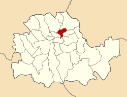
 Shoreditch shown within the County of London | |
| Area | |
| • 1911/1931 | 658 acres (2.66 km2) |
| • 1961 | 659 acres (2.67 km2) |
| Population | |
| • 1911 | 111,390 |
| • 1931 | 97,042 |
| • 1961 | 40,455 |
| Density | |
| • 1911 | 169/acre |
| • 1931 | 147/acre |
| • 1961 | 61/acre |
| History | |
| • Origin | Shoreditch and Norton Folgate |
| • Created | 1899 |
| • Abolished | 1965 |
| • Succeeded by | London Borough of Hackney |
| Status | Metropolitan borough |
| Government | Shoreditch Borough Council |
| • HQ | Old Street |
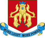
| • Motto | More Light, More Power |
 Coat of Arms adopted by the Borough Council | |
 Map of borough boundary Map of borough boundary | |
The Metropolitan Borough of Shoreditch was a metropolitan borough of the County of London between 1899 and 1965, when it was merged with the Metropolitan Borough of Stoke Newington and the Metropolitan Borough of Hackney to form the London Borough of Hackney.
The borough was made up of three main districts, Shoreditch, Hoxton and Haggerston, and covered much of the north-western and northern East End of London. An individual coat of arms was never granted to the metropolitan borough council; they adopted the arms of the second lord of the manor of Shoreditch, John de Northampton.