| Mica Dam | |
|---|---|
 Aerial view of the Mica Dam | |
| Location | Mica Creek, British Columbia, Canada |
| Coordinates | 52°04′40″N 118°33′59″W / 52.07778°N 118.56639°W |
| Construction began | 1967[1] |
| Opening date | March 23, 1973[1] |
| Owner(s) | BC Hydro |
| Dam and spillways | |
| Type of dam | Embankment dam |
| Impounds | Columbia River |
| Height | 240 m (787 ft) |
| Reservoir | |
| Creates | Kinbasket Lake |
| Total capacity | 24.762 km3 (20,075,000 acre⋅ft)[2] |
| Surface area | 430 km2 (170 sq mi) |
| Power Station | |
| Commission date | 1976–1977[3] |
| Turbines | 6[4] |
| Installed capacity | 2,805 MW |
| Capacity factor | 29.3% |
| Annual generation | 7,200 GWh[5][6] |
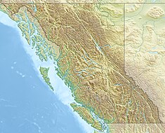
Mica Dam is a hydroelectric embankment dam spanning the Columbia River 135 kilometres north of Revelstoke, British Columbia, Canada. It was built as one of three Canadian projects under the terms of the 1964 Columbia River Treaty and is operated by BC Hydro. Completed in 1973, the Mica powerhouse had an original generating capacity of 1,805 megawatts (MW). Mica Dam, named after the nearby settlement of Mica Creek and its associated stream, in turn named after the abundance of mica minerals in the area, is one of the largest earthfill dams in the world. The reservoir created by the dam is Kinbasket Lake. Water from the dam flows south directly into Revelstoke Lake, the reservoir for the Revelstoke Dam. Mica Dam is the tallest dam in Canada and second tallest in North America after the Chicoasén Dam in Mexico and it is the farthest upstream dam on the Columbia River.[7] The dam's underground powerhouse was the second largest in the world at the time of its construction, and was the first 500 kV installation of sulphur hexafluoride (SF6) insulated switchgear in the world.[8]
- ^ a b Cite error: The named reference
balanceofpowerwas invoked but never defined (see the help page). - ^ "Columbia River Treaty: Detailed Operating Plan for Canadian Storage" (PDF). Columbia River Treaty Operating Committee. Columbia River Treaty 2014/2024 Review. June 2008. Archived from the original (PDF) on 2014-02-21. Retrieved 2015-01-05.
- ^ Cite error: The named reference
expansionwas invoked but never defined (see the help page). - ^ BC Hydro (2014). "Columbia Region". Archived from the original on 2015-01-04. Retrieved 2015-01-03.
- ^ "Mica Units 5 and 6 Projects: Project Update August 2011" (PDF). BC Hydro. August 2011. Retrieved 2012-08-25.[permanent dead link]
- ^ van Groll, Jonathan (July 3, 2018). Value of pumped storage systems in British Columbia (Thesis). University of British Columbia. p. 117. doi:10.14288/1.0368788. Archived from the original on February 15, 2020. Retrieved April 28, 2020.
- ^ "Columbia River Basin Clickable Map". United States Army Corps of Engineers. Archived from the original on 2015-01-05. Retrieved 2015-01-04.
- ^ "Mica Dam". IBEW Local 993: Northern BC & The Yukon. 7 October 2015. Archived from the original on April 29, 2020. Retrieved April 29, 2020.
