| Middleton | |
|---|---|
 All Saints' Church, Milton Keynes Village | |
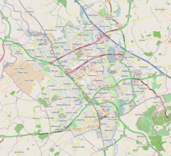
Mapping © OpenStreetMap Location within Buckinghamshire | |
| Population | 5,624 (2011 Census, civil parish)[1] |
| OS grid reference | SP888390 |
| Civil parish |
|
| Unitary authority | |
| Ceremonial county | |
| Region | |
| Country | England |
| Sovereign state | United Kingdom |
| Post town | MILTON KEYNES |
| Postcode district | MK10 |
| Dialling code | 01908 |
| Police | Thames Valley |
| Fire | Buckinghamshire |
| Ambulance | South Central |
| UK Parliament | |
Middleton is an area of Milton Keynes, a city in Buckinghamshire, England, and part of the civil parish of Milton Keynes.[a] Its historic centre is Milton Keynes Village, the village that in 1967 gave its name to the city of which it is now a small part.[2] It is delineated by Childs Way to the north, Tongwell Street to the east, Chaffron Way to the south and Brickhill Street to the west. The River Ouzel runs diagonally through it, from west to north.
- ^ UK Census (2011). "Local Area Report – Milton Keynes (E04001263)". Nomis. Office for National Statistics. Retrieved 19 November 2019.
- ^ Dave Persaud. "Father of the New City: Lord Campbell of Eskan, first Chair of Milton Keynes Development Corporation". Milton Keynes: Living Archive.
Labour Minister Dick Crossman who "…looked at [a] map and saw [the] name and said 'Milton the poet, Keynes the economic one. Planning with economic sense and idealism, a very good name for it.'"
Cite error: There are <ref group=lower-alpha> tags or {{efn}} templates on this page, but the references will not show without a {{reflist|group=lower-alpha}} template or {{notelist}} template (see the help page).


