Midland County | |
|---|---|
 Midland County Courthouse | |
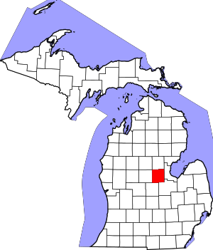
 Location within the U.S. state of Michigan | |
 Michigan's location within the U.S. | |
| Coordinates: 43°38′N 84°23′W / 43.64°N 84.39°W | |
| Country | |
| State | |
| Founded | 1831, reorganized 1855[1] |
| Seat | Midland |
| Largest city | Midland |
| Area | |
| • Total | 528 sq mi (1,370 km2) |
| • Land | 516 sq mi (1,340 km2) |
| • Water | 12 sq mi (30 km2) 2.2% |
| Population (2020) | |
| • Total | 83,494 |
| • Density | 162/sq mi (63/km2) |
| Time zone | UTC−5 (Eastern) |
| • Summer (DST) | UTC−4 (EDT) |
| Congressional districts | 2nd, 8th |
| Website | www |
Midland County is a county located in the U.S. state of Michigan. As of the 2020 census, the population was 83,494.[2] The county seat is Midland.[3] The county's name is due to its closeness to the geographical Lower Peninsula's geographical center. It was founded in 1831. However, it was not until 1855 that the county was effectively organized.[1]
Midland County comprises the Midland, MI Metropolitan Statistical Area and is included in the Saginaw–Midland–Bay City Combined Statistical Area in the Mid/Central Michigan region.
- ^ a b "Bibliography on Midland County". Clarke Historical Library, Central Michigan University. Retrieved January 20, 2013.
- ^ "State & County QuickFacts". United States Census Bureau. Retrieved September 15, 2021.
- ^ "Find a County". National Association of Counties. Retrieved June 7, 2011.
