Miles City Airport Frank Wiley Field | |||||||||||||||
|---|---|---|---|---|---|---|---|---|---|---|---|---|---|---|---|
| Summary | |||||||||||||||
| Airport type | Public | ||||||||||||||
| Owner | Miles City | ||||||||||||||
| Serves | Miles City, Montana | ||||||||||||||
| Elevation AMSL | 2,630 ft / 802 m | ||||||||||||||
| Coordinates | 46°25′41″N 105°53′10″W / 46.42806°N 105.88611°W | ||||||||||||||
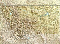
| Map | |||||||||||||||
Location in Montana Location in the United States | |||||||||||||||
 | |||||||||||||||
| Runways | |||||||||||||||
| |||||||||||||||
| Statistics (2009) | |||||||||||||||
| |||||||||||||||
Miles City Airport[1] or Frank Wiley Field[2] (IATA: MLS, ICAO: KMLS, FAA LID: MLS) is a city-owned airport two miles northwest of Miles City, in Custer County, Montana, United States.[2] The airport was served by one airline, subsidized by the Essential Air Service program. EAS subsidies ended on July 15, 2013, due to subsidy per passenger exceeding $1000, leaving Miles City without scheduled air service.[3]
Federal Aviation Administration records say the airport had 264 passenger boardings (enplanements) in calendar year 2008,[4] 891 in 2009 and 1,033 in 2010.[5] The National Plan of Integrated Airport Systems for 2011–2015 called it a general aviation airport (the commercial service category requires 2,500 enplanements per year).[6]
Scheduled air service temporarily ceased on March 8, 2008, when Big Sky Airlines ended operations in bankruptcy. Great Lakes Airlines was given USDOT approval to take over Essential Air Service (EAS)[7] and flights began in 2009. From 2011 to 2013, service had been provided under EAS contract by Silver Airways (formerly Gulfstream International Airlines).
- ^ a b "Miles City Airport (Frank Wiley Field)". Miles City government website. Retrieved September 8, 2009.
- ^ a b c FAA Airport Form 5010 for MLS PDF. Federal Aviation Administration. Effective April 5, 2012.
- ^ Falstad, Jan. Lewistown, Miles City losing airline subsidies, Billings Gazette, June 13, 2013, Retrieved 2013-06-13
- ^ "Enplanements for CY 2008" (PDF, 1.0 MB). CY 2008 Passenger Boarding and All-Cargo Data. Federal Aviation Administration. December 18, 2009.
- ^ "Enplanements for CY 2010" (PDF, 189 KB). CY 2010 Passenger Boarding and All-Cargo Data. Federal Aviation Administration. October 4, 2011.
- ^ "2011–2015 NPIAS Report, Appendix A" (PDF). National Plan of Integrated Airport Systems. Federal Aviation Administration. October 4, 2010. Archived from the original (PDF, 2.03 MB) on September 27, 2012.
- ^ "Great Lakes prepares for Montana routes". Sidney Herald. Montana. December 30, 2007. Retrieved February 3, 2008.

