Mill Village, Pennsylvania | |
|---|---|
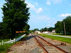
 Site of the Mill Village station along the Erie Railroad | |
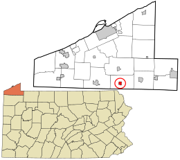
 Location in Erie County and the U.S. state of Pennsylvania. | |
| Coordinates: 41°52′34″N 79°58′21″W / 41.87611°N 79.97250°W | |
| Country | United States |
| State | Pennsylvania |
| County | Erie |
| Government | |
| • Mayor | Joseph Sam |
| Area | |
| • Total | 0.92 sq mi (2.38 km2) |
| • Land | 0.92 sq mi (2.38 km2) |
| • Water | 0.00 sq mi (0.00 km2) |
| Elevation [2] (Borough benchmark) | 1,206 ft (368 m) |
| Highest elevation [2] (south borough boundary) | 1,320 ft (400 m) |
| Lowest elevation [2] (Tributary to French Creek) | 1,160 ft (350 m) |
| Population | |
| • Total | 388 |
| • Density | 422.20/sq mi (163.09/km2) |
| Time zone | UTC-4 (EST) |
| • Summer (DST) | UTC-5 (EDT) |
| ZIP code | 16427 |
| Area code | 814 |
| Website | millvillageboro |
Mill Village is a borough in Erie County, Pennsylvania, United States. The population was 394 at the 2020 census,[4] down from 412 during the 2010 census. It is part of the Erie Metropolitan Statistical Area.
- ^ "ArcGIS REST Services Directory". United States Census Bureau. Retrieved October 12, 2022.
- ^ a b c "New Ireland Topo Map, Erie County PA (Waterford Area)". TopoZone. Locality, LLC. Retrieved 2 September 2019.
- ^ Cite error: The named reference
USCensusDecennial2020CenPopScriptOnlywas invoked but never defined (see the help page). - ^ Bureau, US Census. "City and Town Population Totals: 2020-2021". Census.gov. US Census Bureau. Retrieved 19 July 2022.
{{cite web}}:|last1=has generic name (help)