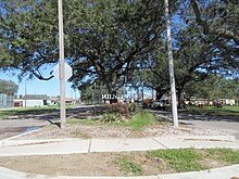
Milneburg
Milne Gentilly | |
|---|---|
| Coordinates: 30°01′09″N 90°03′12″W / 30.01917°N 90.05333°W | |
| Country | United States |
| State | Louisiana |
| City | New Orleans |
| Planning District | District 6, Gentilly District |
| Area | |
| • Total | 0.73 sq mi (1.9 km2) |
| • Land | 0.73 sq mi (1.9 km2) |
| • Water | 0.00 sq mi (0.0 km2) |
| Elevation | 0 ft (0 m) |
| Population (2010) | |
| • Total | 1,450 |
| • Density | 2,000/sq mi (770/km2) |
| Time zone | UTC-6 (CST) |
| • Summer (DST) | UTC-5 (CDT) |
| Area code | 504 |

Milneburg is a neighborhood of the city of New Orleans. A subdistrict of the Gentilly District Area, its boundaries as defined by the City Planning Commission are: Leon C. Simon Drive to the north, People's Avenue to the east, Filmore Ave to the south and Elysian Fields Avenue to the west, putting it within the 8th Ward of New Orleans. The Milneburg neighborhood takes its name from Milneburg, a historic town and neighborhood formerly located a short distance north of the modern neighborhood.