| Minnesota Valley State Recreation Area | |
|---|---|
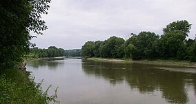
 The Minnesota River from the Gifford Lake unit of the Minnesota Valley State Recreation Area | |
| Location | Scott County, Minnesota, United States |
| Coordinates | 44°39′43″N 93°42′12″W / 44.66194°N 93.70333°W |
| Area | 5,490 acres (22.2 km2) |
| Established | 1969 |
| Governing body | Minnesota Department of Natural Resources |
Minnesota Valley State Recreation Area is a 5,490-acre (2,222 ha) unit of the Minnesota state park system in Scott County, Minnesota, the United States. The park is not continuous but is composed of waysides, four of which are strung along the Minnesota River between Shakopee and Belle Plaine. The various waysides are interspersed with units of the Minnesota Valley National Wildlife Refuge, a part of the Mississippi National River and Recreation Area. Although the state recreation area is managed by the Minnesota Department of Natural Resources and the national wildlife refuge by the United States Fish and Wildlife Service, both agencies share a consistent signage to simplify visitation.

