Mioarele | |
|---|---|
 Ski slope in Mățău-Chilii | |
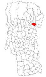
 Location in Argeș County | |
| Coordinates: 45°14′14″N 25°4′27″E / 45.23722°N 25.07417°E | |
| Country | Romania |
| County | Argeș |
| Government | |
| • Mayor (2020–2024) | Gheorghe Șucu[1] (PNL) |
| Area | 33 km2 (13 sq mi) |
| Highest elevation | 1,017 m (3,337 ft) |
| Population (2021-12-01)[2] | 1,442 |
| • Density | 44/km2 (110/sq mi) |
| Time zone | EET/EEST (UTC+2/+3) |
| Postal code | 117480-117484, 117486 |
| Vehicle reg. | AG |
| Website | www |
Mioarele, formerly known as Mățău, is a commune in Argeș County, Muntenia, Romania. Located 4 kilometers southeast of Câmpulung,[3] on the way to Târgoviște, it touches both the Argeș River valley[4] and the banks of its Argeșel tributary.[5][6] It is composed of five villages: Mățău (the commune center), with Chilii and Cocenești, as one cluster; Suslănești, the oldest surviving village, is located farther to the east, alongside Aluniș. The commune, like Câmpulung itself, is located just below the Southern Carpathians, and includes Mățău peak, held as the tallest hill in Romania, as well as sediments with fossilized fish from the Oligocene period. Mățău and especially Suslănești are traditional centers for horticulture, as well as for the related plum-brandy industry.
The area engaged in commerce since Antiquity, when it was used as a trading post by the Dacians. Its history remained obscure during the early medieval interlude, and down to the foundation of an early Romanian polity, though archeological finds suggest that the defunct village of Hobaia, located on commune grounds, was inhabited as early as the 10th century AD. Toponymic clues have led historians to suppose that Mioarele's inhabitants included Early Slavs and Cumans, and that some part of the village may be known in written records from 1401 or 1402. A component of Muscel County in Wallachia, Suslănești was first mentioned in 1503, due to its participation in trade with the Transylvanian Saxons; it and Hobaia were inhabited by yeomen—some of whom advanced into Muscel's boyardom, while others became their serfs, and then their sharecroppers. While Hobaia was destroyed in mysterious circumstances, a dominant clan, the Jumăreas, emerged at Suslănești during the 17th century. The Jumărea ascendancy coincided with a regional migration, at the end of which Mățău was established as a secondary hamlet.
This new settlement thrived while Suslănești went into a relative decline, its land encroached upon by several monastery estates and boyar families—including the Rucăreanus, who had a long feud with the Jumăreas and the other remaining yeomen. Large property was consolidated under the Kingdom of Romania, down to a land reform in 1944. Present-day Mioarele was noted as a scene of heavy fighting during the Romanian withdrawal in World War I, and was vandalized by the Central Powers during a two-year occupation (1916–1918). It emerged from the war as a hub of agrarian politics and an electoral pool for the National Peasants' Party. The decline of the peasant class was curtailed when locals were encouraged to cultivate themselves and advance socially, including by migrating into other areas of the country. Driven by schoolteachers such as Ion Vișoianu and Ion Gh. Nicolaescu-Mățău, this effort made Mățău and Suslănești stand out as the ancestral homeland for a large number of cultural and political notabilities; figures to trace their origin to the area include Muscel's Prefect Alexandru Mușetescu, literary scholar Dan Simonescu, and writer Tudor Mușatescu.
The education-driven institutional modernization was doubled from the 1940s by attempts to introduce intensive horticulture and improve transportation. Such objectives were realized by the communist regime, which incorporated the villages under a single commune in 1956–1967, and made it part of Argeș County in 1968; it also introduced the collectivization of farmlands, with a large-scale cultivation of orchards, and conscripted local youth in projects of road modernization. During its late stages, the regime completed the national road 73, which goes around Mioarele. After the Romanian Revolution of 1989, the commune remained underdeveloped due to water deficiencies, though it also completed Argeș's first-ever ski slope, in 2007.
- ^ (in Romanian) Primăria Mioarele. Conducere. Primar, at the Argeș County Council site
- ^ "Populaţia rezidentă după grupa de vârstă, pe județe și municipii, orașe, comune, la 1 decembrie 2021" (XLS). National Institute of Statistics.
- ^ (in Romanian) Primăria Mioarele. Informații. Prezentare comună at the Argeș County Council site
- ^ Ioana Proca Floria, "Splendorile naturii. Punctul fosilifer de la Suslănești", in Magazin, Vol. XLVIII, Issue 13, March 2005, p. 10
- ^ Dinu, p. 285; Nicolescu et al., p. 56
- ^ Dan Simonescu, "Din istoria folclorului și folcloristicii. Folcloristul C. Rădulescu-Codin (1875—1926)", in Revista de Folclor, Issue 4/1957, p. 102
