Mirkovci | |
|---|---|
 | |
 | |
| Coordinates: 45°16′16″N 18°51′00″E / 45.271°N 18.850°E | |
| Country | |
| Region | Syrmia (Podunavlje) |
| County | |
| City | Vinkovci |
| Area | |
| • Total | 26.0 km2 (10.0 sq mi) |
| Elevation | 95[2] m (311.68 ft) |
| Population (2021)[3] | |
| • Total | 2,731 |
| • Density | 110/km2 (270/sq mi) |
| Demonym(s) | Mirkovčanin (♂) Mirkovčanka (♀) (per grammatical gender) |
| Time zone | UTC+1 (CET) |
| • Summer (DST) | UTC+2 (CEST) |
| Vehicle registration | VK |
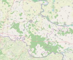
Mirkovci (Serbian Cyrillic: Мирковци, Hungarian: Szegfalu, German: Sankt Emrich) is a village and suburb of the town of Vinkovci in eastern Croatia. It is geographically within the Syrmia and Podunavlje region. The village is located immediately southeast of Vinkovci separated from the rest of the town by Vinkovci-Gunja railway. At the time of 2011 Census, the local population was 3,283.
Mirkovci is a multiethnic settlement with Croat majority and Serb minority. Up until the end of the Croatian War of Independence Serbs were the majority population.
- ^ Register of spatial units of the State Geodetic Administration of the Republic of Croatia. Wikidata Q119585703.
- ^ "Mirkovci". Croatian Encyclopedia.
- ^ "Population by Age and Sex, by Settlements" (xlsx). Census of Population, Households and Dwellings in 2021. Zagreb: Croatian Bureau of Statistics. 2022.


