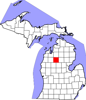
Missaukee County | |
|---|---|
 Missaukee County Courthouse in Lake City | |
 Location within the U.S. state of Michigan | |
 Michigan's location within the U.S. | |
| Coordinates: 44°20′N 85°06′W / 44.34°N 85.1°W | |
| Country | |
| State | |
| Founded | 1840 (created) 1871 (organized)[1] |
| Seat | Lake City |
| Largest city | Lake City |
| Area | |
• Total | 574 sq mi (1,490 km2) |
| • Land | 565 sq mi (1,460 km2) |
| • Water | 9.1 sq mi (24 km2) 1.6% |
| Population (2020) | |
• Total | 15,052 |
| • Density | 26/sq mi (10/km2) |
| Time zone | UTC−5 (Eastern) |
| • Summer (DST) | UTC−4 (EDT) |
| Congressional district | 1st |
| Website | www |

Missaukee County (/mɪˈsɔːki/ mih-SAW-kee) is a county located in the U.S. state of Michigan. As of the 2020 census, the population was 15,052.[2] The county seat is Lake City.[3]
Missaukee County is part of the Cadillac, MI micropolitan statistical area. The county is considered to be part of Northern Michigan.
- ^ "Bibliography on Missaukee County". Clarke Historical Library, Central Michigan University. Retrieved January 20, 2013.[dead link]
- ^ "State & County QuickFacts". United States Census Bureau. Retrieved September 15, 2021.
- ^ "Find a County". National Association of Counties. Retrieved June 7, 2011.