Missoula County | |
|---|---|
 Missoula County Courthouse | |
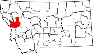
 Location within the U.S. state of Montana | |
 Montana's location within the U.S. | |
| Coordinates: 47°02′N 113°56′W / 47.04°N 113.93°W | |
| Country | |
| State | |
| Founded | December 14, 1860 |
| Seat | Missoula |
| Largest city | Missoula |
| Area | |
• Total | 2,618 sq mi (6,780 km2) |
| • Land | 2,593 sq mi (6,720 km2) |
| • Water | 25 sq mi (60 km2) 1.0% |
| Population (2020) | |
• Total | 117,922 |
• Estimate (2022) | 121,041 |
| • Density | 45/sq mi (17/km2) |
| Time zone | UTC−7 (Mountain) |
| • Summer (DST) | UTC−6 (MDT) |
| Congressional district | 1st |
| Website | www |
| |
Missoula County /mɪˈzuːlə/ is a county located in the State of Montana. As of the 2020 census, the population was 117,922,[1] making it Montana's third most populous county. Its county seat and most populous city is Missoula.[2] The county was founded in 1860.[3]
Missoula County comprises the Missoula, MT Metropolitan Statistical Area, and is not a consolidated city-county.
- ^ "State & County QuickFacts". United States Census Bureau. Retrieved April 5, 2023.
- ^ "Find a County". National Association of Counties. Retrieved June 7, 2011.
- ^ Cite error: The named reference
Montana Place Nameswas invoked but never defined (see the help page).