Mitchell Highway –New South Wales | |
|---|---|
 | |
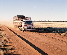
| Road freight on the Mitchell Highway between Cunnamulla and Charleville, 1979 | |
 | |
| General information | |
| Type | Highway |
| Length | 1,095 km (680 mi)[1] |
| Gazetted | August 1928 (as Main Road 7)[2] |
| Route number(s) |
|
| Former route number |
|
| Major junctions | |
| North end | Augathella, Queensland |
| South end | Bathurst, New South Wales |
| Location(s) | |
| Major settlements | Charleville, Cunnamulla, Bourke, Nyngan, Dubbo, Orange, Bathurst |
| Highway system | |
| ---- | |
Mitchell Highway is an outback state highway located in the central and south western regions of Queensland and the northern and central western regions of New South Wales in Australia. The southern part of Mitchell Highway forms part of the National Highway A32 B71 corridor, which stretches from Sydney to Brisbane via Dubbo. Mitchell Highway also forms part of the shortest route between Sydney and Darwin, via Bourke and Mount Isa, making it an important road link for the transport of passengers and freight for regional New South Wales and Queensland.[3] The highway is a part of route Alternative A2 between Augathella and Charleville, route A71 and B71 between Charleville and Nyngan, and part of route A32 between Nyngan and Bathurst.
In New South Wales, the highway's south-eastern terminus is at its junction with Great Western and Mid-Western Highways, and it links with Golden, Newell, Oxley, Barrier and Kamilaroi Highways. In Queensland, the highway links with Balonne and Warrego Highways and its northern terminus is at its junction with Landsborough Highway.
- ^ "Mitchell Highway" (Map). Google Maps. Retrieved 4 April 2015.
- ^ "Main Roads Act, 1924-1927". Government Gazette of the State of New South Wales. No. 110. National Library of Australia. 17 August 1928. pp. 3814–20. Archived from the original on 3 August 2022. Retrieved 1 August 2022.
- ^ Sinclair Knight Merz Pty Ltd (June 2007). Sydney–Dubbo Corridor Strategy: Building our National Transport Future (PDF). Australia: Department of Transport and Regional Services. ISBN 978-1-921095-46-7. Archived from the original (PDF) on 20 March 2015. Retrieved 4 April 2015.
{{cite book}}:|work=ignored (help)