Mitzpe Ramon
| |
|---|---|
| Hebrew transcription(s) | |
| • ISO 259 | Miçpe Ramon |
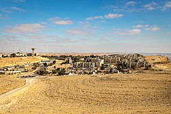
 View of Mitzpe Ramon from Har Gamal, 2022 | |
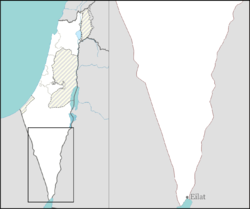
| Coordinates: 30°36′46″N 34°48′14″E / 30.61278°N 34.80389°E | |
| Country | |
| District | Southern |
| Founded | 1951 |
| Government | |
| • Head of Municipality | Elia Winter[1] |
| Area | |
| • Total | 62,875 dunams (62.875 km2 or 24.276 sq mi) |
| Elevation | 839 m (2,753 ft) |
| Population (2022)[2] | |
| • Total | 5,263 |
| • Density | 84/km2 (220/sq mi) |
| Name meaning | Ramon Lookout |
| Website | mitzpe-ramon |
Mitzpe Ramon (Hebrew: מִצְפֵּה רָמוֹן, Ramon Lookout; Arabic: متسبي رمون) is a local council in the Negev desert of southern Israel. It is situated on the northern ridge at an elevation of 860 meters (2,800 feet) overlooking the world's largest erosion cirque, known as the Makhtesh Ramon.[3] In 2022 it had a population of 5,263.[2]
- ^ "תוצאות הבחירות המקומיות 2024". TheMarker (in Hebrew). 2024-03-03. Retrieved 2024-05-07.
- ^ a b "Regional Statistics". Israel Central Bureau of Statistics. Retrieved 21 March 2024.
- ^ The list said go to Batumi and Eilat but I got other ideas, New York Times

