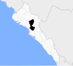
Municipality of Mocorito | |
|---|---|
 Location of the municipality in Sinaloa | |
| Coordinates: 25°29′00″N 107°55′00″W / 25.48333°N 107.91667°W | |
| Country | |
| State | Sinaloa |
| Seat | Mocorito |
| Government | |
| • Municipal President | María Elizalde Ruelas |
| Area | |
| • Total | 2,800 km2 (1,100 sq mi) |
| Elevation | 187 m (614 ft) |
| Population (2020) | |
| • Total | 30,358 |
| • Density | 14.4/km2 (37/sq mi) |
| Time zone | UTC-7 (Mountain Standard Time) |
| • Summer (DST) | UTC-6 (Mountain Daylight Time) |
| Website | www |
Municipality of Mocorito is a municipality in the Mexican state of Sinaloa in northwestern Mexico.[1] It is bordered to the north by the municipality of Sinaloa, to the south by Navolato, to the southeast by Culiacán, to the east by Badiraguato and to the west with Salvador Alvarado and Angostura. It encompasses a total of 2,800.6 km² and represents 4.9% of the territory of Sinaloa. According to the 2020 census it had a population of 40,358, compromising 270 total localities. Major localities include Pericos, Mocorito, and Caimanero.
- ^ "Sinaloa". Enciclopedia de los Municipios de México. Instituto Nacional para el Federalismo y el Desarrollo Municipal. Archived from the original on 28 January 2007. Retrieved January 11, 2010.