Mojave, California | |
|---|---|
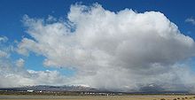
 LADWP Mojave District Headquarters | |
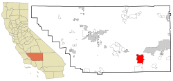
 Location in Kern County and the state of California | |
| Coordinates: 35°03′09″N 118°10′26″W / 35.05250°N 118.17389°W | |
| Country | United States |
| State | California |
| County | Kern |
| Government | |
| • State senator | Shannon Grove (R)[1] |
| • Assemblymember | Tom Lackey (R)[1] |
| • U. S. rep. | Jay Obernolte (R)[2] |
| Area | |
| • Total | 58.375 sq mi (151.191 km2) |
| • Land | 58.29 sq mi (150.970 km2) |
| • Water | 0.085 sq mi (0.220 km2) 0.146% |
| Elevation | 2,762 ft (842 m) |
| Population | |
| • Total | 4,699 |
| • Density | 80/sq mi (31/km2) |
| Time zone | UTC-8 (PST) |
| • Summer (DST) | UTC-7 (PDT) |
| ZIP codes | 93501, 93502, 93519 |
| Area code | 661 |
| FIPS code | 06-48452 |
| GNIS feature ID | 1652752 |
| Website | visitmojave.com |


Mojave (formerly Mohave)[4] is an unincorporated community in Kern County, California, United States. Mojave is located 50 miles (80 km) east of Bakersfield, and 100 miles (161 km) north of Los Angeles,[6] at an elevation of 2,762 feet (842 m).[4] The town is located in the western region of the Mojave Desert, below and east of Oak Creek Pass and the Tehachapi Mountains. Mojave is on the Pacific Crest Trail.[7]
The population was 4,238 at the 2010 census, up from 3,836 at the 2000 census. Telephone numbers in Mojave follow the format (661) 824-xxxx and the area includes three postal ZIP Codes.
- ^ a b "Statewide Database". Regents of the University of California. Archived from the original on February 1, 2015. Retrieved May 8, 2015.
- ^ "California's 23rd Congressional District - Representatives & District Map". Civic Impulse, LLC.
- ^ "2010 Census U.S. Gazetteer Files – Places – California". United States Census Bureau.
- ^ a b c U.S. Geological Survey Geographic Names Information System: Mojave, California
- ^ "US Census Bureau". www.census.gov. Retrieved September 3, 2024.
- ^ Durham, David L. (1998). California's Geographic Names: A Gazetteer of Historic and Modern Names of the State. Clovis, Calif.: Word Dancer Press. p. 1074. ISBN 1-884995-14-4.
- ^ "Pacific Crest Trail Towns - HikerFeed".
