| Mona Vale | |
|---|---|
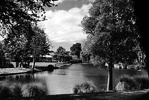
 The Avon River at Mona Vale | |
 | |
| Type | Public park |
| Location | Christchurch |
| Coordinates | 43°31′23.89″S 172°36′30.67″E / 43.5233028°S 172.6085194°E |
| Area | 4 ha |
| Created | 1899 |
| Operated by | Christchurch City Council |
| Status | Open all year |
| Official name | Mona Vale |
| Designated | 7-Apr-1983 |
| Reference no. | 283 |
| Official name | Mona Vale Gatehouse |
| Designated | 7-Apr-1983 |
| Reference no. | 1799 |
Mona Vale, with its homestead formerly known as Karewa, is a public park of 4 ha in the Christchurch suburb of Fendalton. The homestead and gate house are both listed as heritage buildings with Heritage New Zealand (NZHPT). The fernery and the rose garden, and pavilion with the setting of the park along the Avon River, add to the attractiveness of the property. It is one of the major tourist attractions of Christchurch.