Mongalla | |
|---|---|
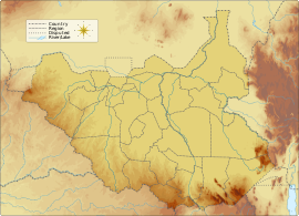
 Map showing location of Mongalla in relation to the South Sudanese capital of Juba | |
| Coordinates: 5°11′56″N 31°46′10″E / 5.198933°N 31.769511°E | |
| Country | |
| State | Central Equatoria |
| County | Juba |
| Time zone | UTC+2 (CAT) |
| Climate | Aw |
Mongalla or Mangalla is a Payam in Juba County, Central Equatoria State in South Sudan,[1] on the east side of the Bahr al Jebel or White Nile river. It lies about 75 km by road northeast of Juba. The towns of Terekeka and Bor lie downstream, north of Mongalla.
During the colonial era, Mongalla was capital of Mongalla Province, which reached south to Uganda and east towards Ethiopia. On 7 December 1917 the last of the northern Sudanese troops were withdrawn from Mongalla, replaced by Equatorial troops. These southern and at least nominally Christian troops remained the only permanent garrison of the town and province until their mutiny in August 1955. Mongalla and the surrounding province was then absorbed into Equatoria Province in 1956. The town was taken and retaken more than once during the Second Sudanese Civil War (1983–2005).
An experimental station was established to grow sugar at Mongalla in the 1950s, and there were plans to establish commercial operations. However, after independence in 1956 the Khartoum government shifted the sugar project to the north, where it is grown under much less favorable conditions with heavy irrigation. A sugar, clothing, and a weaving factory was established in Mongalla in the 1970s but operations failed to get beyond their trial phase and diminished as conflict grew in the region in the early 1980s. In April 2006 the President of Southern Sudan, Salva Kiir Mayardit, named Mongalla as one of the Nile ports to be the first to be rehabilitated.
Mongalla is an important center for gauging the flow of the Nile, with measurements taken regularly from 1905 until 1983, and since 2004.
- ^ Kwajok, Lako Jada (29 May 2016). "Taking a closer look at the controversial 28 states". South Sudan Nation. Retrieved 12 August 2016.
