| Mongpan မိုင်းပန်နယ် | |||||||||
|---|---|---|---|---|---|---|---|---|---|
| State of the Shan States | |||||||||
| 1637–1959 | |||||||||
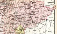
 Möng Pan State in an Imperial Gazetteer of India map | |||||||||
| Capital | Mong Pan | ||||||||
| Area | |||||||||
• 1901 | 3,703 km2 (1,430 sq mi) | ||||||||
| Population | |||||||||
• 1901 | 16,629 | ||||||||
| History | |||||||||
• State founded | 1637 | ||||||||
• Abdication of the last Saopha | 1959 | ||||||||
| |||||||||

Mongpan (also spelt Möngpan), also known as Maingpan (Burmese: မိုင်းပန်) was a Shan state in what is today Burma. It belonged to the Eastern Division of the Southern Shan States.
The town of Mong Pan was formerly the residence of the Sawbwa of Mongpan State. The capital is in the middle of a fertile plain. Most of the other areas of the state are mountainous, rich in teak forests. Loi Hkilek, a 2,133 high mountain is located in Mongkyawt District.[1]