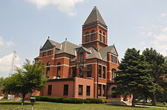
Monona County | |
|---|---|
 | |
 Location within the U.S. state of Iowa | |
 Iowa's location within the U.S. | |
| Coordinates: 42°02′50″N 95°58′07″W / 42.047222222222°N 95.968611111111°W | |
| Country | |
| State | |
| Founded | 1851 |
| Seat | Onawa |
| Largest city | Onawa |
| Area | |
• Total | 699 sq mi (1,810 km2) |
| • Land | 694 sq mi (1,800 km2) |
| • Water | 4.9 sq mi (13 km2) 0.7% |
| Population (2020) | |
• Total | 8,751 |
| • Density | 13/sq mi (4.8/km2) |
| Time zone | UTC−6 (Central) |
| • Summer (DST) | UTC−5 (CDT) |
| Congressional district | 4th |
| Website | www |
Monona County is a county located in the U.S. state of Iowa. As of the 2020 census, the population was 8,751.[1] The county seat is Onawa.[2][3]
- ^ "2020 Census State Redistricting Data". census.gov. United states Census Bureau. Retrieved August 12, 2021.
- ^ "Find a County". National Association of Counties. Retrieved June 7, 2011.
- ^ Monona County Economic Development Partnership for Growth