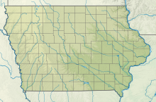
42°13′13″N 091°09′48″W / 42.22028°N 91.16333°W
Monticello Regional Airport | |||||||||||||||
|---|---|---|---|---|---|---|---|---|---|---|---|---|---|---|---|
| Summary | |||||||||||||||
| Airport type | Public | ||||||||||||||
| Owner | City of Monticello | ||||||||||||||
| Serves | Monticello, Iowa | ||||||||||||||
| Elevation AMSL | 833 ft / 254 m | ||||||||||||||
| Map | |||||||||||||||
 | |||||||||||||||
| Runways | |||||||||||||||
| |||||||||||||||
| Statistics | |||||||||||||||
| |||||||||||||||
Monticello Regional Airport (IATA: MXO, ICAO: KMXO, FAA LID: MXO), formerly known as Monticello Municipal Airport, is a public airport located two miles (3 km) southeast of the central business district of Monticello, a city in Jones County, Iowa, United States. It is owned by the City of Monticello.[1]
- ^ a b FAA Airport Form 5010 for MXO PDF, effective September 15, 2016.

