Morristown, New York | |
|---|---|
 | |
| Coordinates: 44°35′8″N 75°38′53″W / 44.58556°N 75.64806°W | |
| Country | United States |
| State | New York |
| County | St. Lawrence |
| Area | |
| • Total | 1.02 sq mi (2.65 km2) |
| • Land | 0.98 sq mi (2.54 km2) |
| • Water | 0.04 sq mi (0.10 km2) |
| Elevation | 289 ft (88 m) |
| Population (2010) | |
| • Total | 395 |
| • Estimate (2019)[3] | 377 |
| • Density | 383.91/sq mi (148.22/km2) |
| Time zone | UTC-5 (EST) |
| • Summer (DST) | UTC-4 (EDT) |
| FIPS code | 36-48571 |
| GNIS feature ID | 0976680 |
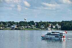
Morristown is a hamlet and former village along the Saint Lawrence River in St. Lawrence County, New York, United States. The population was 395 at the 2010 census. The village is named after Gouverneur Morris.
The hamlet is on the northern edge of the Town of Morristown and was north of Gouverneur.
Jacques Cartier State Park is southwest of the village.
The former village has their own school, Morristown Central School.
- ^ "Geographic Names Information System". edits.nationalmap.gov. Retrieved March 13, 2022.
- ^ "2019 U.S. Gazetteer Files". United States Census Bureau. Retrieved July 27, 2020.
- ^ "Population and Housing Unit Estimates". United States Census Bureau. May 24, 2020. Retrieved May 27, 2020.
