| Morrow Point Reservoir | |
|---|---|
 The reservoir, frozen over in winter, as seen from Hermit's Rest | |
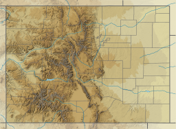
| Location | Gunnison and Montrose Counties, Colorado |
| Coordinates | 38°27′06″N 107°32′14″W / 38.45165°N 107.53728°W |
| Type | Hydroelectric Reservoir |
| Part of | Wayne N. Aspinall Storage Unit (Bureau of Reclamation) |
| Primary inflows | Gunnison River, Curecanti Creek, Blue Creek |
| Managing agency | Curecanti National Recreation Area (National Park Service) |
| First flooded | 1968 |
| Max. length | 12 miles (19 km) |
| Surface area | 817 acres (331 ha) |
| Water volume | 117,190 acre-feet (144.55 GL) |
| Surface elevation | 7,160 feet (2,180 m) |
| Settlements | Gunnison, Colorado; Montrose, Colorado |
| Website | https://www.nps.gov/cure/index.htm |
Morrow Point Reservoir is an 817-acre (331 ha) artificial reservoir on the Gunnison River in western Colorado. Located in the upper Black Canyon of the Gunnison, the lake was created in 1968 by the U.S. Bureau of Reclamation as part of a larger plan to impound the upper section of the Gunnison and create opportunities for hydroelectric power generation, water conservation, and recreation.[1] Morrow Point Reservoir is managed by the National Park Service as a unit within the Curecanti National Recreation Area, and is the location of the Curecanti Needle, a striking 700-foot (210 m) granite spire on the reservoir's southern bank whose unique shape was for decades a recognized symbol of the Denver and Rio Grande Western Railroad.[2]

