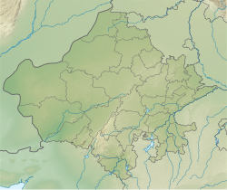
Mount Abu
Abu Parvat | |
|---|---|
 | |
| Coordinates: 24°35′33″N 72°42′30″E / 24.5925°N 72.7083°E | |
| Country | India |
| State | Rajasthan |
| District | Sirohi |
| Elevation | 1,220 m (4,000 ft) |
| Population (2011)[1] | |
| • Total | 22,943 |
| • Density | 50/km2 (100/sq mi) |
| Time zone | UTC+5:30 (IST) |
| PIN | 307501 |
| Telephone code | +02974 |
| ISO 3166 code | RJ-IN |
| Vehicle registration | RJ 38 |
| Nearest city | Abu Road, Udaipur, Ahmedabad, Gandhinagar, |
Mount Abu () is a hill station in the Aravalli Range in the Sirohi district of the state of Rajasthan in western India. The mountain forms a rocky plateau 22 km long by 9 km wide. It is referred to as 'an oasis in the desert' as its heights are home to rivers, lakes, waterfalls and evergreen forests. It is also home to numerous Hindu and Jain temples.
- ^ "Census of India: Search Details". censusindia.gov.in. Archived from the original on 24 September 2015. Retrieved 10 May 2015.

