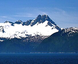
| Mount Ada | |
|---|---|
 North-northeast aspect | |
| Highest point | |
| Elevation | 4,528 ft (1,380 m)[1][2] |
| Prominence | 4,328 ft (1,319 m)[2] |
| Parent peak | Peak 4650[3] |
| Isolation | 19.44 mi (31.29 km)[3] |
| Coordinates | 56°40′49″N 134°41′42″W / 56.6802450°N 134.6949850°W[4] |
| Naming | |
| Etymology | Ada Lester Jones |
| Geography | |
| Country | United States |
| State | Alaska |
| City and Borough | Sitka |
| Protected area | South Baranof Wilderness |
| Parent range | Alexander Archipelago[2] |
| Topo map | USGS Port Alexander C-3 |
Mount Ada is a 4,528-foot-elevation (1,380-meter) mountain summit in Alaska, United States.
- ^ Donald J. Orth, Dictionary of Alaska Place Names, U.S. Government Printing Office, 1967, page 46.
- ^ a b c "Mount Ada, Alaska". Peakbagger.com. Retrieved 2024-01-24.
- ^ a b "Ada, Mount - 4,550' AK". listsofjohn.com. Retrieved 2024-01-19.
- ^ "Mount Ada". Geographic Names Information System. United States Geological Survey, United States Department of the Interior. Retrieved 2024-01-24.
