| Mount Arthur | |
|---|---|
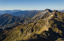
 Wharepapa / Arthur Range, taken from the track leading to the summit | |
| Highest point | |
| Elevation | 1,795 m (5,889 ft)[1] |
| Listing | Mountains of New Zealand |
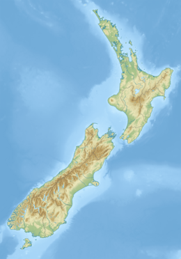
| Coordinates | 41°13′04″S 172°40′53″E / 41.21778°S 172.68139°E[2] |
| Naming | |
| Native name | Tuao Wharepapa (Māori) |
| Geography | |
| Country | New Zealand |
| District | Buller |
| Protected area | Kahurangi National Park |
| Parent range | Wharepapa / Arthur Range |
Mount Arthur (Tuao Wharepapa in Māori) is in the Wharepapa / Arthur Range in the north western area of the South Island of New Zealand.[3] Mount Arthur, named after Captain Arthur Wakefield,[4] lies within Kahurangi National Park and has a peak elevation of 1,795 metres (5,889 ft).
- ^ "Mt Arthur". SummitPost.org. Retrieved 12 January 2015.
- ^ "Mount Arthur, Tasman - NZ Topo Map". topomap.co.nz. Retrieved 2 April 2023.
- ^ "Place name detail: Mount Arthur". New Zealand Gazetteer. New Zealand Geographic Board. Retrieved 28 June 2012.
- ^ "Mount Arthur and the Tableland". TheProw.org.nz. Retrieved 2 April 2023.
