| Mount Cabuyao | |
|---|---|
| Mount Kabuyao | |
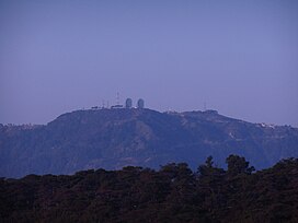
 Mount Cabuyao with the landmark two satellite dishes on its summit | |
| Highest point | |
| Elevation | 2,025 m (6,644 ft)[1] |
| Prominence | 84 m (276 ft) |
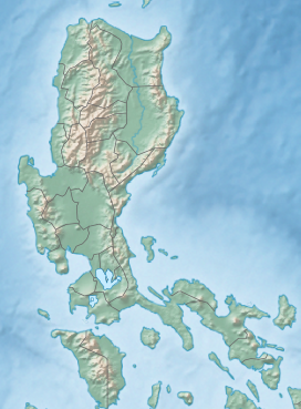
| Coordinates | 16°21′23″N 120°33′32.8″E / 16.35639°N 120.559111°E |
| Geography | |
| Country | Philippines |
| Region | Cordillera Administrative Region |
| Province | Benguet |
| City/municipality | Tuba |
| Parent range | Cordillera Central |
| Climbing | |
| Easiest route | Hike |
Mount Cabuyao (alternatively spelled as Mount Kabuyao) is a mountain in the Philippines located in the municipality of Tuba in the province of Benguet. Its summit, rising to more than 2,000 metres (6,600 ft) above sea level,[1][2] overlooks the city of Baguio. It is commonly mistaken as Mount Santo Tomas, a taller mountain just beside it.[1]
Due to its high elevation, several communications companies constructed relay stations and radars at the summit.[3] A private observatory and AA radar station, once operated by the US Armed Forces stationed in the country, is also located here. A water catchment area was constructed to supply water to the City of Baguio and nearby towns. A small community of farmers live at the top of the mountain.[4] A town hall and a school was built for them by the local government.
- ^ a b c "Mt. Cabuyao (2,025 +) / Mt. Sto. Tomas (2,256 +)". Pinoy Mountaineer. April 19, 2008. Retrieved September 30, 2014.
- ^ Tupaz, Voltaire (May 6, 2012). "Bikers race to raise funds for Cordillera forests". Rappler. Retrieved September 30, 2014.
- ^ "List of Field Stations, Northern Luzon PRSD". PAGASA. Archived from the original on October 6, 2014. Retrieved September 30, 2014.
- ^ "La Trinidad mayor wants more farmers to engage in strawberry production". DWDD (1134 kHz Metro Manila). March 5, 2014. Archived from the original on October 6, 2014. Retrieved October 1, 2014.

