| Mount Gipps Queensland | |||||||||||||||
|---|---|---|---|---|---|---|---|---|---|---|---|---|---|---|---|
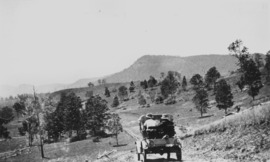 Mount Gipps on McPherson Range, 1928 | |||||||||||||||
 Mount Gipps | |||||||||||||||
| Coordinates | 28°19′20″S 153°00′35″E / 28.3222°S 153.0097°E | ||||||||||||||
| Population | 0 (2021 census)[1] | ||||||||||||||
| • Density | 0.00/km2 (0.00/sq mi) | ||||||||||||||
| Postcode(s) | 4285 | ||||||||||||||
| Area | 15.7 km2 (6.1 sq mi) | ||||||||||||||
| Time zone | AEST (UTC+10:00) | ||||||||||||||
| Location |
| ||||||||||||||
| LGA(s) | Scenic Rim Region | ||||||||||||||
| State electorate(s) | Scenic Rim | ||||||||||||||
| Federal division(s) | Wright | ||||||||||||||
| |||||||||||||||
Mount Gipps is a rural locality in the Scenic Rim Region, Queensland, Australia.[2] In the 2021 census, Mount Gipps had "no people or a very low population".[1]
The locality borders New South Wales [3] and is one end of the Queensland rabbit-proof fence.[4]
- ^ a b Cite error: The named reference
Census2021was invoked but never defined (see the help page). - ^ "Mount Gipps – locality in Scenic Rim Region (entry 45173)". Queensland Place Names. Queensland Government. Retrieved 29 December 2020.
- ^ "Queensland Globe". State of Queensland. Retrieved 4 May 2020.
- ^ "Information on the Darling Downs-Moreton Rabbit Board". Darling Downs-Moreton Rabbit Board. 28 January 2015. Archived from the original on 26 February 2015. Retrieved 21 August 2015.