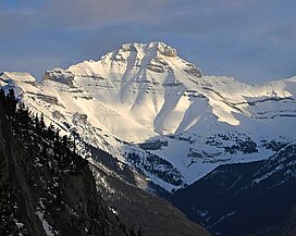
| Mount Inglismaldie | |
|---|---|
 Mount Inglismaldie in winter | |
| Highest point | |
| Elevation | 2,964 m (9,724 ft)[1] |
| Prominence | 160 m (520 ft)[2] |
| Coordinates | 51°14′30″N 115°25′15″W / 51.24167°N 115.42083°W[1] |
| Geography | |
| Location | Alberta, Canada |
| Parent range | Fairholme Range Canadian Rockies |
| Topo map | NTS 82O3 Canmore |
| Geology | |
| Rock age | Cambrian |
| Rock type | sedimentary rock |
| Climbing | |
| First ascent | 1933[1] |
| Easiest route | Scramble |

Mount Inglismaldie is the second-highest peak of the Fairholme Range in Banff National Park. It is located immediately west of Mount Girouard in the Bow River valley south of Lake Minnewanka.
The mountain was named in 1886 by park superintendent George A. Stewart after Inglismaldie Castle in Kincardineshire, Scotland.[1]
The first ascent of the mountain was made in 1933 by H. Foster, J. Packer, M.C. Wylie, Betts, Dickson, W. Innes, L. DeCouteur, J. Miskow, Sadler, and Vallance with guide Lawrence Grassi.[1]
- ^ a b c d e "Mount Inglismaldie". cdnrockiesdatabases.ca. Retrieved 2019-09-13.
- ^ "Mount Inglismaldie". Bivouac.com. Retrieved 2006-09-27.

