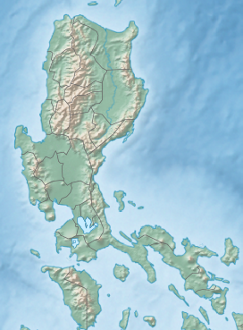
| Mount Labo | |
|---|---|
 | |
| Highest point | |
| Elevation | 1,544 m (5,066 ft)[1][2] |
| Prominence | 1,524 m (5,000 ft)[3] |
| Isolation | 73.5 km (45.7 mi)[4] |
| Listing | |
| Coordinates | 14°00′48″N 122°47′15″E / 14.01333°N 122.78750°E[3] |
| Geography | |
| Country | Philippines |
| Region | Bicol Region |
| Province | Camarines Norte |
| Geology | |
| Mountain types | [2] |
| Volcanic belt | Bicol Volcanic belt |
| Last eruption | Pleistocene [2] |
Mount Labo, is a potentially active stratovolcano in the province of Camarines Norte, in the Bicol Region (Region V), on Luzon Island, in the Philippines. It is located at the northwest end of the Bicol Peninsula.
- ^ "Labo". Philippine Institute of Volcanology and Seismology. Archived from the original on 1 Sep 2011. Retrieved 19 March 2019.
- ^ a b c "Labo". Global Volcanism Program. Smithsonian Institution. Archived from the original on 13 Jul 2017. Retrieved 19 March 2019.
- ^ a b "Philippines Mountains"". peaklist.org. Retrieved 3 March 2013.
- ^ "Mount Labo, Philippines". Peakbagger.com. Retrieved 8 September 2020.


