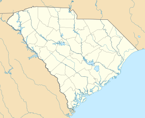
Mount Pleasant | |
|---|---|
 | |
| Coordinates: 32°47′13″N 79°52′35″W / 32.78694°N 79.87639°W | |
| Country | United States |
| State | South Carolina |
| County | Charleston |
| Settled | July 6, 1680 |
| Founded | 1776 (Greenwich) 1803 (Mount Pleasant) |
| Consolidated | 1837[1] |
| Named for | Hibben House[2] |
| Government | |
| • Mayor | Will Haynie |
| Area | |
| • Total | 58.66 sq mi (151.92 km2) |
| • Land | 49.55 sq mi (128.32 km2) |
| • Water | 9.11 sq mi (23.60 km2) 15.53% |
| Elevation | 16 ft (5 m) |
| Population | |
| • Total | 90,801 |
| • Estimate (2023) | 95,232 |
| • Rank | 4th in South Carolina |
| • Density | 1,832.70/sq mi (707.60/km2) |
| Time zone | UTC−5 (EST) |
| • Summer (DST) | UTC−4 (EDT) |
| ZIP codes | 29464-29466, 29429 |
| Area code | 843, 854 |
| FIPS code | 45-48535[5] |
| GNIS feature ID | 1224770[6] |
| Website | www |
Mount Pleasant is a large suburban town in Charleston County, South Carolina, United States. In the Lowcountry, it is the fourth-most populous municipality in South Carolina, and for several years was one of the state's fastest-growing areas, doubling in population between 1990 and 2000. The population was 90,801 at the 2020 census.[7] It is part of the Charleston metropolitan area.[8]
At the foot of the Arthur Ravenel Bridge is Patriots Point, a naval and maritime museum, home to the World War II aircraft carrier USS Yorktown, which is now a museum ship. The Ravenel Bridge, an eight-lane highway that is part of U.S. Route 17 and was completed in 2005, spans the Cooper River and links Mount Pleasant with the city of Charleston.[9]
- ^ "Mount Pleasant Historic District, Charleston County (Mount Pleasant)". South Carolina Department of Archives and History. Retrieved March 11, 2023.
- ^ "Old Village Historic District". www.tompsc.com. Retrieved December 7, 2022.
- ^ "ArcGIS REST Services Directory". United States Census Bureau. Retrieved October 15, 2022.
- ^ Cite error: The named reference
USCensusDecennial2020CenPopScriptOnlywas invoked but never defined (see the help page). - ^ "U.S. Census website". United States Census Bureau. Retrieved May 14, 2011.
- ^ "US Board on Geographic Names". United States Geological Survey. October 25, 2007. Retrieved January 31, 2008.
- ^ Cite error: The named reference
2020CensusQuickFactswas invoked but never defined (see the help page). - ^ "Charleston-North Charleston, SC Metropolitan Statistical Area" (PDF). census.gov. Retrieved September 10, 2023.
- ^ "The Pulse Real Estate Charleston, SC » Mt. Pleasant". thepulsecharleston.com.

