| Mount Shasta Wilderness | |
|---|---|
 Mount Shasta | |
| Location | Siskiyou County, California, United States |
| Nearest city | Mount Shasta City |
| Coordinates | 41°25′08″N 122°12′26″W / 41.41889°N 122.20722°W |
| Area | 38,200 acres (155 km2) |
| Established | 1984 |
| Governing body | U.S. Forest Service |
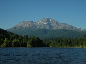
The Mount Shasta Wilderness is a 38,200-acre (155 km2) federally designated wilderness area located 5 miles (8.0 km) east of Mount Shasta City in northern California. The US Congress passed the 1984 California Wilderness Act that set aside the Mount Shasta Wilderness. The US Forest Service is the managing agency as the wilderness is within the Shasta-Trinity National Forest. The area is named for and is dominated by the Mount Shasta volcano which reaches a traditionally quoted height of 14,162 feet (4,317 m) above sea level, but official sources give values ranging from 14,104 feet (4,299 m) from one USGS project,[1] to 14,179 feet (4,322 m) via the NOAA.[2] Mount Shasta is one of only two peaks in the state over 14,000 feet (4,300 m) outside the Sierra Nevada Mountain Range. The other summit is White Mountain Peak in the Great Basin of east-central California.[3]
The Wintun Glacier is located on Mount Shasta and is the lowest-elevation glacier in the state, lying at 9,100 feet (2,800 m) elevation and extending to the summit.[4]
The smaller volcanic cone of Shastina (12,270 ft)[5] lies one mile (1.6 km) west of Mount Shasta and was formed after the ice-age glaciers melted.
The wilderness protects both pristine forests and areas that were intensively logged and roaded in the past. Although less than half of the mountain remains roadless, Mount Shasta Wilderness is still the premier destination for a variety of activities from mountaineering, day-hiking, and backpacking to cross-country skiing, snowshoeing and ski mountaineering. It is valued for the many scenic, geologic and recreational attributes including glaciers, lava flows, hot springs, waterfalls and forests of Shasta red fir, sugar pine and other conifers.
- ^ United States Geological Survey (USGS) Geographical Names Information System(GNIS)
- ^ "Datasheet for benchmark MX1016". National Geodetic Survey. This seems to be the latest and most accurate measurement from the U.S. Geodetic Survey.
- ^ Atkinson, Ron p.224
- ^ Atkinson, Ron p.227
- ^ USGS-GNIS
