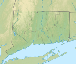
| Mount Tom State Park | |
|---|---|
 Mount Tom Tower | |
| Location | Litchfield, Morris and Washington, Connecticut, United States |
| Coordinates | 41°41′36″N 73°16′24″W / 41.69333°N 73.27333°W[1] |
| Area | 231 acres (93 ha)[2] |
| Elevation | 1,289 ft (393 m)[1] |
| Established | 1915[3] |
| Administered by | Connecticut Department of Energy and Environmental Protection |
| Designation | Connecticut state park |
| Website | Official website |
Mount Tom Tower | |
| Location | Mount Tom State Park, Litchfield County, Connecticut |
| Area | 20 acres (8.1 ha) |
| Built | 1921 |
| Built by | John DaRoss from Litchfield, CT |
| Architect | Alfred M. Turner |
| Architectural style | Late 19th and 20th Century Revivals/Jacobean Revival |
| NRHP reference No. | 93001247 |
| Added to NRHP | December 12, 1993 |
Mount Tom State Park is a public recreation area lying south of US Route 202 in the towns of Washington, Litchfield, and Morris, Connecticut. The state park occupies 231 acres (93 ha) on the southwest shore of Mount Tom Pond[4] and is home to the Mount Tom Tower, which was listed on the National Register of Historic Places in 1993.[5] It is managed by the Connecticut Department of Energy and Environmental Protection.[3]
- ^ a b "Mount Tom". Geographic Names Information System. United States Geological Survey, United States Department of the Interior.
- ^ Cite error: The named reference
pristaffwas invoked but never defined (see the help page). - ^ a b Cite error: The named reference
DEEPwas invoked but never defined (see the help page). - ^ Cite error: The named reference
DEEPmapwas invoked but never defined (see the help page). - ^ Cite error: The named reference
registrationwas invoked but never defined (see the help page).

