| Mount Wutai | |
|---|---|
| 五台山 | |
 Mount Wutai from the air | |
| Highest point | |
| Elevation | 3,061 m (10,043 ft) |
| Coordinates | 39°04′45″N 113°33′53″E / 39.07917°N 113.56472°E |
| Geography | |
Wutai County, Shanxi, China | |
| Climbing | |
| Easiest route | Hike |
| Criteria | Cultural: ii, iii, iv, vi |
| Reference | 1279 |
| Inscription | 2009 (33rd Session) |
| Area | 18,415 ha |
| Buffer zone | 42,312 ha |
| Mount Wutai | |||||||||||||||||||||||||||||
|---|---|---|---|---|---|---|---|---|---|---|---|---|---|---|---|---|---|---|---|---|---|---|---|---|---|---|---|---|---|
| Chinese | 五台山 | ||||||||||||||||||||||||||||
| Literal meaning | "Five-Terrace Mountain" | ||||||||||||||||||||||||||||
| |||||||||||||||||||||||||||||
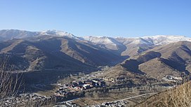
Mount Wutai, also known by its Chinese name Wutaishan and as Mount Qingliang, is a sacred Buddhist site at the headwaters of the Qingshui in Shanxi Province, China. Its central area is surrounded by a cluster of flat-topped peaks or mesas roughly corresponding to the cardinal directions. The north peak (Beitai Ding or Yedou Feng) is the highest (3,061 m or 10,043 ft from sea) and is also the highest point in North China.
As host to over 53 sacred monasteries, Mount Wutai is home to many of China's most important monasteries and temples. It was inscribed as a UNESCO World Heritage Site in 2009[1] and named a AAAAA tourist attraction by China's National Tourism Administration in 2007.
