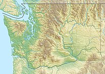
| Mount Zion | |
|---|---|
| Highest point | |
| Elevation | 4,278 ft (1,304 m) NGVD 29[1] |
| Prominence | 1,318 ft (402 m)[1] |
| Coordinates | 47°55′24″N 123°00′38″W / 47.9234239°N 123.0104492°W[2] |
| Geography | |
| Location | Clallam County, Washington, U.S. |
| Parent range | Olympic Mountains |
| Topo map | USGS Mount Zion |
| Climbing | |
| Easiest route | Trail hike |
Mount Zion is a 4,278-foot (1,304 m) peak in the Olympic National Forest. The peak is located 9.5 miles (15.3 km) northwest of Quilcene, and near Lords Lake and Bon Jon Pass. Billed as one of the easier hikes in the Olympics,[3] Zion offers a 1,340-foot (410 m) elevation gain in just under 2 miles (3.2 km).[4]
- ^ a b "Mount Zion, Washington". Peakbagger.com.
- ^ "Mount Zion". Geographic Names Information System. United States Geological Survey, United States Department of the Interior.
- ^ "Mt. Zion Trail #836" (PDF). Retrieved 2009-09-05.
- ^ Olympic Mountain Rescue (Society) (1988). Climber's guide to the Olympic Mountains (3rd ed.). Seattle: Mountaineers Books. p. 129. ISBN 0-89886-154-3.
