Moyna
Moynagarh | |
|---|---|
Community development block | |
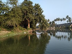
 Moyna Garh island | |
 | |
| Coordinates: 22°14′00″N 87°47′00″E / 22.233333°N 87.783333°E | |
| Country | |
| State | West Bengal |
| District | Purba Medinipur |
| Government | |
| • Type | Community development block |
| Area | |
| • Total | 154.51 km2 (59.66 sq mi) |
| Elevation | 6 m (20 ft) |
| Population (2011) | |
| • Total | 226,927 |
| • Density | 1,500/km2 (3,800/sq mi) |
| Languages | |
| • Official | Bengali, English |
| Time zone | UTC+5:30 (IST) |
| Area code | 03228 |
| ISO 3166 code | IN-WB |
| Vehicle registration | WB-29, WB-30, WB-31, WB-32, WB-33 |
| Literacy | 86.33% |
| Lok Sabha constituency | Tamluk |
| Vidhan Sabha constituency | Moyna |
| Website | purbamedinipur |
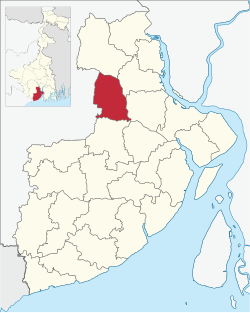
Moyna is a community development block that forms an administrative division in Tamluk subdivision of Purba Medinipur district in the Indian state of West Bengal.
