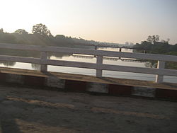
| Mu River | |
|---|---|
 Mu River | |
 | |
| Nickname(s) | Mu Chaung |
| Native name | Mu Myit (Burmese) |
| Location | |
| Country | Burma |
| Physical characteristics | |
| Source | Kabaw Valley |
| Mouth | Ayeyarwady River |
• location | Myinmu, Myanmar |
• coordinates | 21°56′N 95°38′E / 21.933°N 95.633°E |
| Length | 275 km (171 mi) |
| Basin size | 12,355 km2 (4,770 sq mi) to 19,739.7 km2 (7,621.5 sq mi)[1] |
| Discharge | |
| • location | Near mouth |
| • average | 375.5 m3/s (13,260 cu ft/s)[1] |
Mu River (Burmese: မူးမြစ်; MLCTS: mu: mrac; IPA: [mú mjɪʔ]) is a river in upper central Myanmar (Burma), and a tributary of the country's chief river, the Irrawaddy. It drains the Kabaw valley and part of the Dry Zone between the Ayeyarwady to the east and its largest tributary the Chindwin River to the west. It flows directly north to south for about 275 km (171 mi) and enters the Ayeyarwady west of Sagaing near Myinmu.[2]
Its catchment area above the Kabo weir is 12,355 square kilometres (4,770 sq mi). River flow and rainfall are both seasonal and erratic, at its lowest from January to April, rising sharply during May and June, and high from August to October.[3] Because the Mu lies within the Dry Zone in the rain shadow of the Arakan Mountains, it receives scanty summer monsoon rainfall with a total streamflow of 350 millimetres (14 in).[4] An old popular expression in Burmese goes thus: Ma myinbu, Mu myit htin (‹See Tfd›မမြင်ဖူး မူးမြစ်ထင်) - If you haven't seen a river before, you'd think the Mu is it. It may also be called Mu Chaung (creek) rather than Mu Myit (river) by some.
The wooded upper Mu valley is populated by the Kadu and Ganan minorities, whereas the fertile lower valley constitutes part of the heartlands of the ethnic majority Bamar.[5]
- ^ a b "Middle Irrawaddy".
- ^ "Mu River". Encyclopædia Britannica online. Retrieved 2008-10-11.
- ^ Hla Baw. "Study on Reuse Water in Shwebo Irrigation Scheme in Myanmar" (PDF). International Commission on Irrigation and Drainage, 1st Asian Regional Conference, Seoul 2001. Retrieved 2008-10-12.[dead link]
- ^ Michael Bonell; et al. Hydrology and Water Management in the Humid Tropics. Cambridge University Press, 1993. p. 59. ISBN 978-0-521-45268-7. Retrieved 2008-10-12.
- ^ "Myanmar States & Divisions - Sagaing". Yadanabon.com. Archived from the original on August 27, 2008. Retrieved 2008-10-11.