Muizenberg | |
|---|---|
|
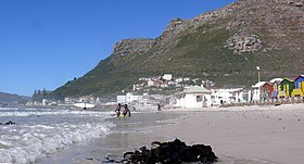
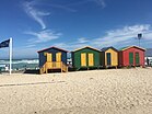
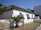
From top left, Muizenberg Railway Station. Surfer's corner at night (top right). Muizenberg beach (centre). The historic beach changing huts on Muizenberg Beach (bottom left). Het Posthuys, a special historical feature in Muizenberg (bottom right). | |
 | |
| Coordinates: 34°06.3′S 18°28.3′E / 34.1050°S 18.4717°E | |
| Country | South Africa |
| Province | Western Cape |
| Municipality | City of Cape Town |
| Established | 1895 |
| Area | |
| • Total | 15.14 km2 (5.85 sq mi) |
| Population (2011)[1] | |
| • Total | 36,857 |
| • Density | 2,400/km2 (6,300/sq mi) |
| Racial makeup (2011) | |
| • Black African | 39.1% |
| • Coloured | 26.2% |
| • Indian/Asian | 1.3% |
| • White | 27.8% |
| • Other | 5.7% |
| First languages (2011) | |
| • English | 44.3% |
| • Afrikaans | 22.8% |
| • Xhosa | 15.3% |
| • Zulu | 1.4% |
| • Other | 16.2% |
| Time zone | UTC+2 (SAST) |
| Postal code (street) | 7945 |
| PO box | 7950 |
| Area code | (021) 787/788 |
Muizenberg (/ˈmjuːzənbɜːrɡ/ MEW-zən-burg,[2] Dutch for 'mice mountain') is a beach-side town in the Western Cape, South Africa. It is situated where the shore of the Cape Peninsula curves round to the east on the False Bay coast. It is considered to be the main surfing spot in Cape Town and is currently home to a surfing community, centered on the popular 'Surfer's Corner'.
- ^ a b c d "Main Place Muizenberg". Census 2011.
- ^ Lass, Roger (1990), "A 'standard' South African vowel system", in Ramsaran, Susan (ed.), Studies in the Pronunciation of English: A Commemorative Volume in Honour of A.C. Gimson, Routledge, p. 283, ISBN 978-0-41507180-2


