Mulga, Alabama | |
|---|---|
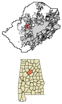
 Location of Mulga in Jefferson County, Alabama. | |
| Coordinates: 33°33′13″N 86°58′31″W / 33.55361°N 86.97528°W | |
| Country | United States |
| State | Alabama |
| County | Jefferson |
| Area | |
| • Total | 0.87 sq mi (2.26 km2) |
| • Land | 0.87 sq mi (2.24 km2) |
| • Water | 0.01 sq mi (0.01 km2) |
| Elevation | 574 ft (175 m) |
| Population (2020) | |
| • Total | 784 |
| • Density | 905.31/sq mi (349.67/km2) |
| Time zone | UTC-6 (Central (CST)) |
| • Summer (DST) | UTC-5 (CDT) |
| ZIP code | 35118 |
| Area code(s) | 205 & 659 |
| FIPS code | 01-52776 |
| GNIS feature ID | 0152567 |
Mulga is a town in western Jefferson County, Alabama, United States. It is north from the Birmingham suburb of Pleasant Grove. It includes the community of Bayview. Mulga was a company town operated by Birmingham Coal and Iron Company around the Mulga Mine and Mulga was also the name of an independent community in the area. The company town was incorporated in 1947.[2]
At its 2010 census the population was 836, down from its peak population of 973 in 2000. Its communities were damaged by an F5 tornado on April 8, 1998. The town's name is possibly derived from the Creek word omalga meaning "all".
Coal has been mined in the area. Forty-one men died in a 1910 coal mine explosion.[3] Steel industry was also active in the area and served by a dam. Rail service was established.
- ^ "2020 U.S. Gazetteer Files". United States Census Bureau. Retrieved October 29, 2021.
- ^ "Mulga - Encyclopedia of Alabama". Encyclopedia of Alabama.
- ^ "The Engineering and Mining Journal 1910-05-07: Vol 89 Iss 19" (PDF).

