| Murrayville Victoria | |||||||||||||||
|---|---|---|---|---|---|---|---|---|---|---|---|---|---|---|---|
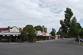
 Reed St, in Murrayville | |||||||||||||||
| Coordinates | 35°15′44″S 141°11′0″E / 35.26222°S 141.18333°E | ||||||||||||||
| Population | 280 (2016 census)[1] | ||||||||||||||
| Postcode(s) | 3512 | ||||||||||||||
| Elevation | 94 m (308 ft) | ||||||||||||||
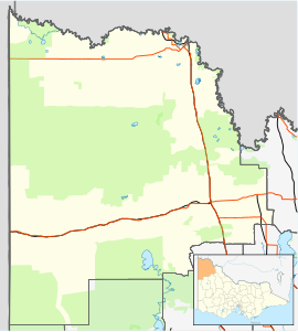
| Location | |||||||||||||||
| LGA(s) | Rural City of Mildura | ||||||||||||||
| Region | Sunraysia | ||||||||||||||
| State electorate(s) | Mildura | ||||||||||||||
| Federal division(s) | Mallee | ||||||||||||||
| |||||||||||||||
Murrayville is a town on the section of the Mallee Highway and Pinnaroo railway line between Ouyen and the South Australian border. It is about 24 kilometres (15 mi) east of the South Australian border and 536 kilometres (333 mi) north west of the state capital Melbourne, but 268 kilometres (167 mi) east of Adelaide. At the 2016 census, Murrayville had a population of 280, down from 444 ten years before.
The local school, Murrayville Community College is a P-12 school.
- ^ Australian Bureau of Statistics (25 October 2007). "Murrayville (State Suburb)". 2006 Census QuickStats. Retrieved 1 October 2007.
- ^ Travelmate
