| Muskegon River | |
|---|---|
 Muskegon River near Newaygo, MI in September 2012 | |
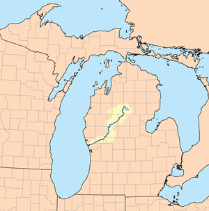
 Map of the Muskegon River | |
| Location | |
| Country | United States |
| State | Michigan |
| Cities | Evart, Big Rapids, Croton, Newaygo, Muskegon |
| Physical characteristics | |
| Source | Houghton Lake |
| • location | Roscommon County, MI |
| • coordinates | 44°23′58″N 84°47′27″W / 44.39944°N 84.79083°W |
| Mouth | Muskegon Lake |
• location | Muskegon, MI |
• coordinates | 43°15′41″N 86°14′53″W / 43.26139°N 86.24806°W |
| Length | 216 mi (348 km) |
| Basin size | 2,350 sq mi (6,100 km2) |
| Discharge | |
| • location | Muskegon, MI |
The Muskegon River (/məˈskiːɡən/ mə-SKEE-gən) is a 216-mile-long (348 km)[1] river in the Lower Peninsula of the U.S. state of Michigan. From its source at Houghton Lake in Roscommon County, the river flows in a generally southwesterly direction to its mouth at Lake Michigan at the eponymous city of Muskegon. The river drains an area of 2,350 square miles (6,100 km2),[2] and collects a number of tributaries, including the Little Muskegon River, Hersey River, and Clam River.
In September 2002, an article in National Geographic raised concerns about a controversial deal made with Nestlé Waters North America, giving them permission "to bottle up to 210 million gallons (about 800 million liters) a year from an aquifer north of Grand Rapids, Michigan that recharges the Muskegon River".[3]
- ^ U.S. Geological Survey. National Hydrography Dataset high-resolution flowline data. The National Map, accessed November 21, 2011
- ^ O'Neal, Richard (July 1997), Muskegon River Watershed Assessment (PDF), Michigan Department of Natural Resources, retrieved 30 July 2011
- ^ Mitchell, John G. (September 2002). "Down the Drain: The Incredible Shrinking Great Lakes". National Geographic. pp. 34–51. Archived from the original on February 7, 2010.