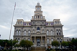
Muskingum County | |
|---|---|
 | |
 Location within the U.S. state of Ohio | |
 Ohio's location within the U.S. | |
| Coordinates: 39°58′N 81°57′W / 39.97°N 81.95°W | |
| Country | |
| State | |
| Founded | March 1, 1804[1] |
| Named for | A Native American word meaning "swampy ground" |
| Seat | Zanesville |
| Largest city | Zanesville |
| Area | |
| • Total | 673 sq mi (1,740 km2) |
| • Land | 665 sq mi (1,720 km2) |
| • Water | 8.0 sq mi (21 km2) 1.2% |
| Population (2020) | |
| • Total | 86,410 |
| • Density | 130/sq mi (50/km2) |
| Time zone | UTC−5 (Eastern) |
| • Summer (DST) | UTC−4 (EDT) |
| Congressional district | 12th |
| Website | www |
Muskingum County (/məˈskɪŋ(ɡ)əm/ mə-SKING-(g)əm) is a county located in the U.S. state of Ohio. As of the 2020 census, the population was 86,410.[2] Its county seat is Zanesville.[3] Nearly bisected by the Muskingum River, the county name is based on a Delaware American Indian word translated as "town by the river"[4][5] or "elk's eye".[6] Muskingum County comprises the Zanesville, OH Micropolitan Statistical Area, which is also included in the Columbus-Marion-Zanesville, OH Combined Statistical Area. The Zanesville Micropolitan Statistical Area is the second-largest statistical area within the Combined Statistical Area, after the Columbus Metropolitan Statistical Area.
- ^ "Ohio County Profiles: Muskingum County" (PDF). Ohio Department of Development. Archived from the original (PDF) on February 16, 2004. Retrieved April 28, 2007.
- ^ 2020 census
- ^ "Find a County". National Association of Counties. Archived from the original on May 31, 2011. Retrieved June 7, 2011.
- ^ "Muskingum County". Ohio History Central. Retrieved January 7, 2019.
- ^ "History of the Muskingum County". Muskingum County Website. Retrieved January 7, 2019.
- ^ First Explorations of Kentucky. Filson Club. 1898. p. 133. Retrieved January 7, 2019.
form the muskingum.

