| Mynydd Twyn-glas | |
|---|---|
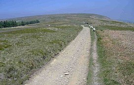
 Track leading up to Mynydd Twyn-glas from the south | |
| Highest point | |
| Elevation | 472 m (1,549 ft) |
| Prominence | 253 m (830 ft) |
| Listing | Marilyn |
| Coordinates | 51°40′27″N 3°04′18″W / 51.6742°N 3.0716°W |
| Naming | |
| English translation | hill of the blue knoll |
| Language of name | Welsh |
| Geography | |
 | |
| Location | Caerphilly, Torfaen, Wales |
| OS grid | ST 259978 |
| Topo map | OS Landranger 171 / Explorer 152 |
Mynydd Twyn-glas is a sprawling 472-metre-high mountain extending into Caerphilly and Torfaen county boroughs in South Wales. It lies southwest of Pontypool, west of Cwmbran and east of Newbridge and taking the form of a rolling plateau the margins of which are defined by steep slopes, many of which are cloaked with conifer plantations. A broad shoulder extending south from the summit is known as Mynydd Maen whilst to the north is Mynydd Llwyd. The thickly afforested northern slopes of the hill drop down steeply into Cwm y Glyn.