This article needs additional citations for verification. (November 2011) |
| N62 road | |
|---|---|
| Bóthar N62 | |
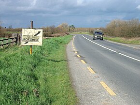
 N62 in County Tipperary with old direction sign | |
| Route information | |
| Length | 96.625 km (60.040 mi) |
| Location | |
| Country | Ireland |
| Primary destinations |
|
| Highway system | |
The N62 road is a national secondary road in Ireland. It links the M6 motorway east of Athlone, County Westmeath with junction 6 of the M8 motorway at Kilnoe near Horse and Jockey in County Tipperary, 96.625 kilometres (60.040 mi) to the south (map).[1] The route also forms a junction with the M7 motorway south of Roscrea.
The government legislation that defines the N62, the Roads Act 1993 (Classification of National Roads) Order 2012 (Statutory Instrument 53 of 2012), provides the following official description:
- N62: Fardrum, County Westmeath - Birr, County Offaly - Horse and Jockey, County Tipperary
- Between its junction with M6 at Creggan Lower in the county of Westmeath and its junction with N52 at Kennedys Cross in the county of Offaly via Creggan Upper, Fardrum, Kilgarvan, Kilbillaghan and Ballynahown in the county of Westmeath: Doon Cross, Corbane; Main Street at Ferbane; Gallen, Noggusduff; Ferbane Street and Banagher Street at Cloghan; Derrinlough and Bollinarig Big in the county of Offaly
- and
- between its junction with N52 at Railway Road in the town of Birr and its junction with the N8 at Kilnoe in the county of North Tipperary via Railway Road in the town of Birr: Rath Beg, Sharavogue and Drumakeenan in the county of Offaly: Birr Road, The Crescent, Lourdes Road and Dublin Road in the town of Roscrea: Benamore, Tullaskeagh, Parkmore, Derrymore, Gortnagowna and Borrisbeg in the county of North Tipperary: Church Street, Main Street, Patrick Street, Richmond and Thurles Road in the town of Templemore: Ballybristy and Knockauns in the county of North Tipperary: Brittas Road, Smith OBrien Street, O’Donovan Rossa Street (and via Parnell Street and Cúchulainn Road) Liberty Square and Slievenamon Road in the town of Thurles: Turtulla Bridge and Drumgower in the county of North Tipperary.[1]
- ^ a b S.I. No. 53/2012 — Roads Act 1993 (Classification of National Roads) Order 2012, Irish Statute Book (irishstatutebook.ie), 2012-02-28.
